New York GIANT Traveling Map - It's Here!
The New York Geographic Alliance is pleased to announce that National Geographic is providing every state with a great resource in September 2016 - the GIANT Traveling Maps. Our map is now here, and it is stunning! The New York map measures about 15 x 20 feet. It is being housed at Monroe Community College in Rochester, but we are serious about the traveling part. During 2016-2017, we hope to have it on display in at least five different places throughout the state. It will definitely be on display at GeoFest 2016 (Nov. 19th). If you are interested in being a host school, please let us know. (Read below).
The map includes many manipulatives to use with the students. There will also be suggested lessons on how to use this resource effectively with elementary students. (We believe the lessons can be modified for 7th grade, too, since that is part of the social studies curriculum for middle school). It is also recommended that you consider borrowing the GIANT NY map for family geography nights.
We sent two teachers (Mackenzie Riegel and Nancy Waldeck) to National Geographic on July 11,12, 2016 for training on the use of these maps. They have reported to us that this training was great, and they have completed two lessons that we will post on Resource page soon. We will keep our members posted about other new developments. If you have any questions about the map, please contact Tim McDonnell or call the NYGA Office at (585)-292-2398.
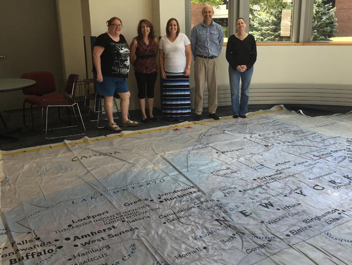
The teachers attending the geospatial training at Monroe Community College got to see the State Giant Traveling Map on August 18th. Prof. Jonathon LIttle is the second from the right.
Note that there are NO shoes (or bare feet) allowed, so they are not ON the map!
Your school could host the map during the school year. Contact Tim McDonnell for more information.